

MB-Research Global Digital Boundaries Release R2026
for Location Intelligence and Geospatial Analysis
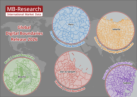
Michael Bauer Research GmbH is pleased to introduce the 2026 edition of its Digital Boundaries, now updated available for very detailed regional granularity across the globe - designed for seamless integration into your GIS workflows.This extensive worldwide dataset provides detailed geographical information, offering administrative, postal, and microgeographic digital maps for countries on every continent for a big range of formats, such as ESRI-Shapefile (.shp), GeoDataBase (.gdb), MapInfo TAB Extended (*.tabx), GeoJSON (*.geojson), GeoPackage (*.gpkg) and in additional formats according to your requirements.
Number of areas shown in parentheses. Please feel free to ask for the complete list!
Please Click here for more information about Digital Boundaries.
We will be happy to inform you about the geographical levels of single countries, our discounted bundle prices for the complete world dataset or for single continents.
Resource for businesses in all sectors
Highly granular maps for 248 countries with polygons for over 2000 geographical levels, makes it a valuable resource for businesses in all sectors – including Retail, Consumer Goods, Capital Goods, e-Commerce, Telecommunications, Media, Healthcare, Logistics, Tourism, Insurance, Reinsurance, Real Estate, Banking and Automotive and much more.Mapping Data for smarter, faster business decisions
Organizations gain clearer insights into complex scenarios and emerging opportunities by transforming raw data into clear, intuitive map based intelligence. With MB-Research Digital Boundaries, you can visualize and analyze data directly on digital maps — from internal revenue and sales figures to precisely matched demographic data from MB-Research. This turns complex datasets into meaningful, actionable insights, empowering businesses to make smarter decisions with confidence.Examples of highly granular data from around the world
Number of areas shown in parentheses. Please feel free to ask for the complete list!
| |||
| Country | Administrative Level | Postal Level | Microgeographical Level |
| France | Communes (34 788) | 5-digit PC (6 051) | IRIS (48 573) |
| Italy | Comuni (7 896) | 5-digit PC (4 700) | Sezioni di Censimento (748 306) |
| Poland | Gminy i Miasta (3 229) | 5-digit PC (20 457) | Obwody Spisowe (192 598) |
| United Kingdom | Districts (361) | PC Units (1 683 580) | Census Output Areas (239 023) |
| |||
| Country | Administrative Level | Postal Level | Microgeographical Level |
| Canada | Census Subdivisions (5 028) | 6-digit PC (838 605) | Dissemination Blocks (498 548) |
| Mexico | Municipios (2 475) | 5-digit PC (32 013) | Áreas Geoestadísticas Básicas urbanas y Municipios (66 437) |
| Puerto Rico | Barrios (901) | 5-digit PC (132) | Grupos de Bloques Censales (2 513) |
| USA | County Subdivisions (35 390) | 5-digit PC (33 774) | Block Groups (239 233) |
| |||
| Country | Administrative Level | Postal Level | Microgeographical Level |
| India | Sub-Districts (6 996) | 6-digit PC (19 373) | Wards and Sub-Districts (11 196) |
| Indonesia | Kabupaten dan Kota (514) | 5-digit PC (11 594) | Desa dan Kelurahan (83 779) |
| Japan | Shikuchōson (1 892) | 7-digit PC (115 354) | Shōchiiki (220 635) |
| Philippines | Municipalities (1 641) | 4-digit PC (1 896) | Barangays (42 028) |
| |||
| Country | Administrative Level | Postal Level | Microgeographical Level |
| Australia | Local Government Areas (546) | 4-digit PC (2 640) | Mesh Blocks (368 049) |
| New Zealand | Statistical Areas 2 (2 311) | 4-digit PC (1 082) | Meshblocks (56 789) |
| |||
| Country | Administrative Level | Postal Level | Microgeographical Level |
| Brazil | Municípios (5 571) | 5-digit PC (26 555) | Setores Censitários (468 091) |
| Columbia | Municipios (1 122) | 6-digit PC (3 681) | Secciones (76 563) |
| Ecuador | Parroquias (1 046) | 6-digit PC (1 225) | Sectores Censales (52 946) |
| Uruguay | Secciones Censales (235) | 5-digit PC (121) | Zonas Censales (78 033) |
| |||
| Country | Administrative Level | Postal Level | Microgeographical Level |
| Nigeria | Local Government Areas (774) | 4-digit PC (339) | - |
| Morocco | Communes (1 687) | 5-digit PC (1 929) | - |
| Tanzania | Wilaya (195) | 5-digit PC (4 066) | Kata (4 344) |
| Tunisia | Al - ʿImādat (2 085) | 4-digit PC (944) | - |
We will be happy to inform you about the geographical levels of single countries, our discounted bundle prices for the complete world dataset or for single continents.